Borasu Pass Trek

Borasu Pass, on the Uttaranchal-Himachal Pradesh border near Tibet, was a trade route between Har ki Dun and Kinnaur. A challenging trek, it offers diverse landscapes of glacier, snow capped mountain, lush green valley for adventurous exploration.

Max Altitude

17880 ft

Duration

9 days

Difficulty Level

Strenous

Total Distance

66 KM

Suitable for

18+ Years Old People

Experience Level

Previous experience of atleast 2 treks above 14000 ft.

Fitness Level

Covers 5 kms distance in 30 minutes without any stress

Overview

Package from and to

Pick up from Dehradun and Drop at Shimla

Region

Uttarakhand / India

Base Camp

Sankri

Rail Head

Dehradun

Airport

Jolly Grant Airport

Trail type

Cross over trail. Trek starts at Sankri in Uttarakhand and ends at Chhitkul in Himachal Pradesh

Best Season

June and September

Snow Period

October to May

Meals

Veg + Egg

Accomodation type

Guest House + Camping

Package Price

₹ 31000/person

Available Batches
Currently no batch is available.
Informations

Borasu Pass Trek

Borasu Pass or Bara-su is a high mountain pass that is located on the border of Uttaranchal and Himachal Pradesh along the border with Tibet. It was an ancient trade route between Har ki Dun valley and Kinnaur valley. It is no longer used by the locals and is an escapade for trekkers and mountaineers.

The trail passes through glacier moraine, steep narrow ridges, sheer vertical snow slopes and boulder fields. All in all, it is a nerve-wracking trek – a stunning mix of backwoods and vast meadows, packed with spurting rivers and widespread glaciers, with a view of snow-capped peaks and massive boulders.

If you’re in the mood for adventure, then perhaps this trek to Borasu Pass is what you need. But note that it’s a difficult and long trek. It is complete with all kinds of landscapes that may require you to use crampons, ice axes and glissade down vertical cliffs, bear the windiest campsites and wade through busy rivers. Situated on the border of Himachal Pradesh and Uttarakhand, close to Tibet, this virgin trail has rarely been explored.

Borasu is one of the four prominent passes of the higher region of Tons and Baspa glaciers. It’s a wonder why it’s rarely treaded on because it is a well-rounded trek that offers multiple landscapes.

Itinenary

Pick up at 8:00 am from Prince Chowk, Dehradun.
Dehradun to Sankri (6400 ft) by shared vehicle. Approx 200 Km – 9/10 hours.
Night stay at Sankri on sharing basis in a guesthouse.

The drive from Dehradun to Sankri is a scenic journey through the beautiful landscapes of Uttarakhand, often undertaken by those heading to the base for treks in the Garhwal region.

The drive takes you through winding roads, charming villages, and lush greenery, offering a delightful journey into the heart of the Garhwal Himalayas. We cross through Mussoorie, Kempty Falls, Mori, Purola, Netwar visualizing the beauty of Himalayas. Be prepared for varying road conditions and consider the weather, as the region can experience snowfall in winter months. It’s advisable to check road conditions and travel updates before undertaking the journey.

Sankri (6400 ft) to Taluka (7200 ft) in a shared camper vehicle (12 kms – 45 mins)
Trek from Taluka (7200 ft) to Puani Garaat (8200 ft) via Gangad (12 kms – 6/7 hrs).

After a healthy breakfast, we leave Sankri for Taluka. The drive to Taluka itself is a adventurous journey on the bumpy roads in a camper vehicle.

Begin your trek from Taluka, a small village in the Uttarkashi district and the starting point of the Har Ki Dun trek. This trail offers a mix of landscapes, including quaint villages, dense forests, and high-altitude meadows. Puani Garaat is often used as a camping site, providing trekkers with a peaceful and scenic place to rest. Today’s trail is a mix of flat walk, gradual ascent and an intermediate steep ascent by the side of Supin River.

Puani Garaat (8200 ft) to Boslo (10000 ft) ( 12 kms – 6/7 hrs).

The trail from Puani Garaat takes a almost flat walk till Seema for 2 kms. Then we cross the bridge on our left side and steeply ascend till Osla village end and take the right trail towards Kalkattiyadhar. The route is a mixture of gradual ascends through cultivation fields and small settlements.

After crossing Kalkattiyadhar trek ahead on a almost flat walk with intermittent ascends to reach Boslo which is a open valley and nearest camping site to Har Ki Doon Valley.


Boslo (10000 ft) to Ratha Tho (13500 ft) via Har Ki Doon (12000 ft) and Marinda Taal (13000 ft).
Approx 9 kms – 7/8 hrs.

The trail from Boslo to Har Ki Doon is a pleasant trail amidst the valley by the side of Supin river. Har Ki Doon valley is a picturesque site to behold the view of Mt. Swargarohini, Hata Peak, Hanuman Mukh Peak, Jaundhar Glacier and surrounding Himalayan Range.

We spend an ample time here to enjoy the nature before heading towards Marinda Taal. We take the left trail from Har ki Doon and ascend steeply for half an hour. Then its a gradual ascend till we reach Marinda Taal which is a natural lake.

Ten minutes into this valley we hit a ten-minute patch of big boulders which on successful crossing leads us to a patch of flat land and then a steady incline. The trail after the lake is gentle humps through golden meadows with a few wildflowers still holding strong in this cold land. After joyously taking your time on the trail, expect to reach Ratha Tho camp just in time for hot lunch.


Ratha Tho (13500 ft) to Upper Lamjung (15500) trek.
Approx 9 kms – 8/9 hours.

The first half hour of the trek is through boulders post which a gradual ascend begins. Two hours after we started to ascend, we hit patches of descent. The valley takes sharp turns and changes direction a lot of time. The river here wears an even deeper colour. The sound of dry leaves crushing under your legs and the texture of the rock as you run your hands on its surface are some sensations you might want to experience. The feeling when the ground is mushy and holds you in your place like it’s telling you to go no further, is surreal. After a 10 minute almost flat walk we reach Saunbhera campsite at the foothill of the glacier.

The trail from here is all boulders which is good practice for what’s to come the next two days. Crossing the flat land of the campsite takes only a few minutes before we reach the foot of the boulders and start our climb up. We follow a narrow ridge all the way up to the small space which will be our campsite for tonight. One and a half hour into the climb, we will reach the top of the first ridge. Take a few minutes to rest and get a bird’s eye view of the campsite of Saunbhera, where veins of streams divide the land into geometric shapes – the flat ground appearing as hexagonal grasslands below. It was one sight we couldn’t tear our gaze away from. After a few minutes of straight walk at the end of the first ridge, we begin incline on the second and the last ridge which should take about half an hour to cover.

The base camp for the pass is called Upper Lamjung. Lamjung, in local language, means ‘Long Moustache’ named as such for the shape of the lower ridges and how they appear from below. The campsite is compact and tricky to set up. It is uneven and full of rocks. Take it from us when we say this is not going to be one of your most comfortable nights in the mountains! The pass hides behind the many folds of the glacier in this area. The campsite here is pretty exciting for it is protected by rockfall by a dip in the terrain. While the dip can keep the rock away, there is no way to stop the continuous sound of the rumble of rocks falling hither thither.

This day will be used as and when required on the trail.

Upper Lamjung (15500 ft) to Bonga (14800 ft) via Borasu Pass (17060 ft).

Approx 10 kms – 11/12 hours.

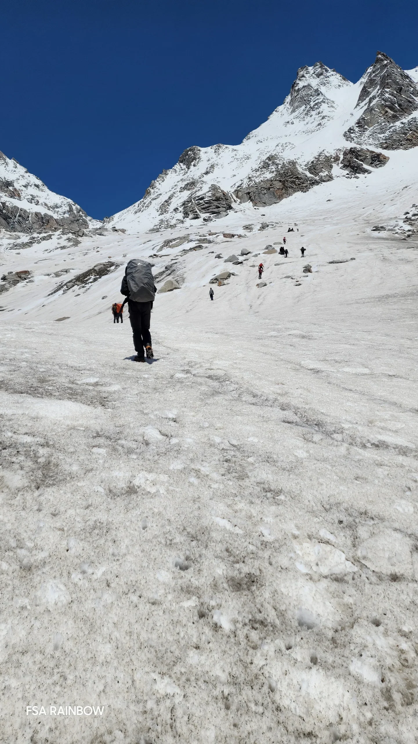
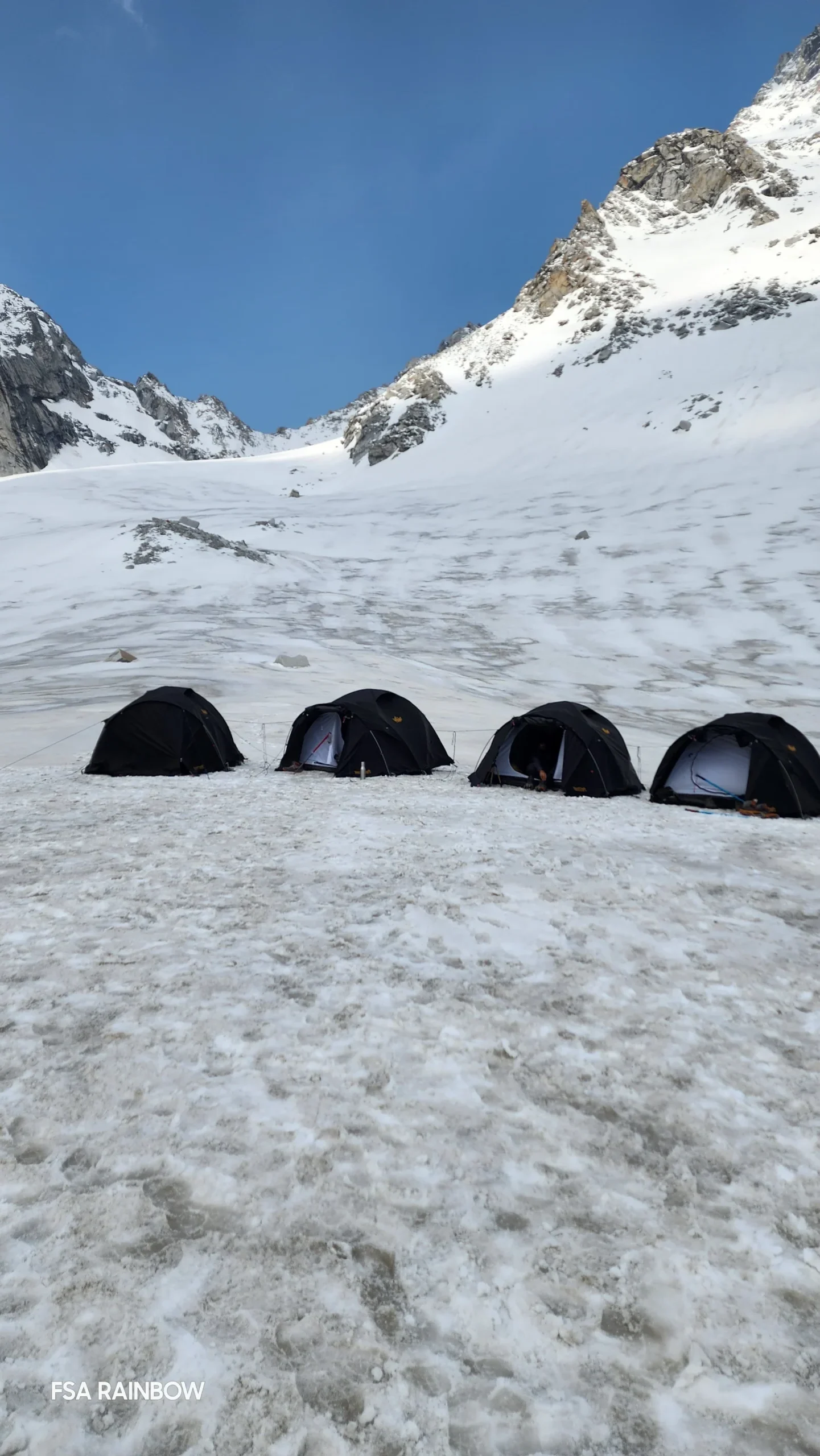
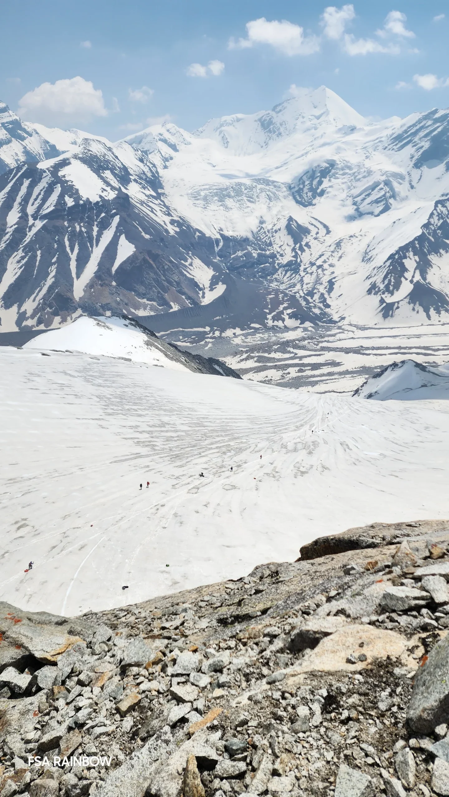
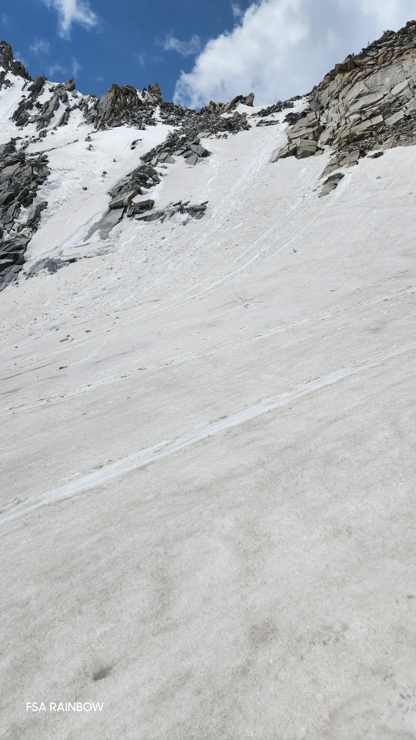
We start as early as possible, even before the sunlight starts chasing peaks, slowly creeping up on one mountain after another as they shed off their darkness little by little. An hour into the steep, heavily bouldered climb, we reach the base of the glacier. This is where we will gear up – put on our crampons/ microspikes. The slope of the glacier is not more than 30 degrees as it starts but very quickly turns into 70 degrees with alternating rock and snow patches a little further up. The last bit up to the pass is almost vertical and can feel a little intimidating.

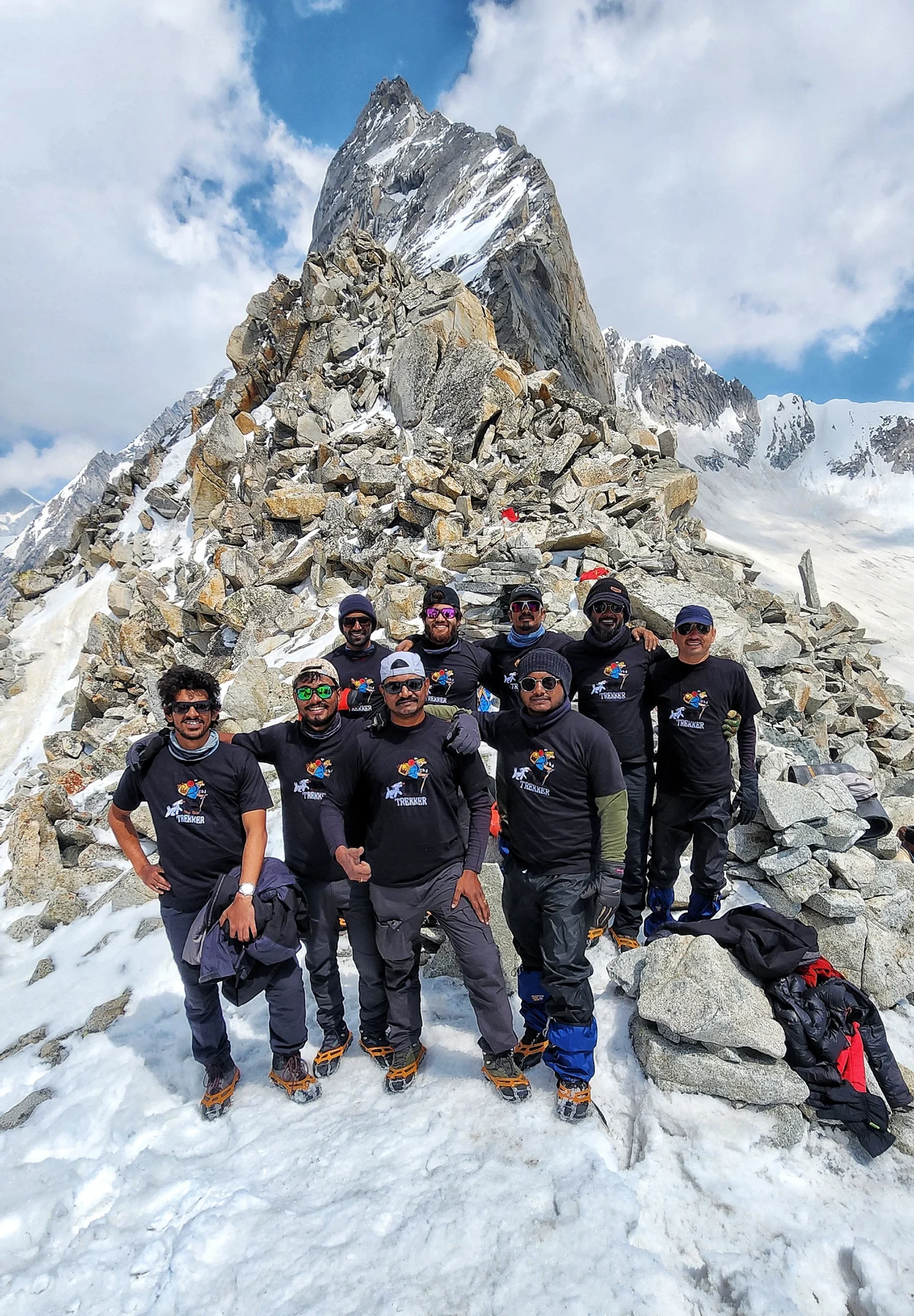
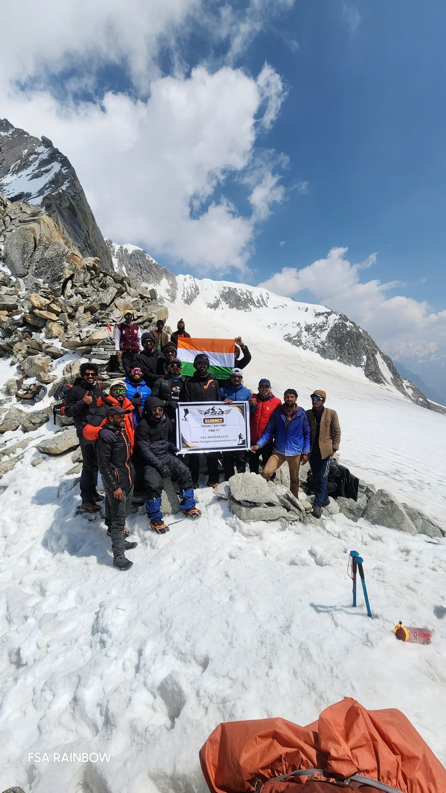
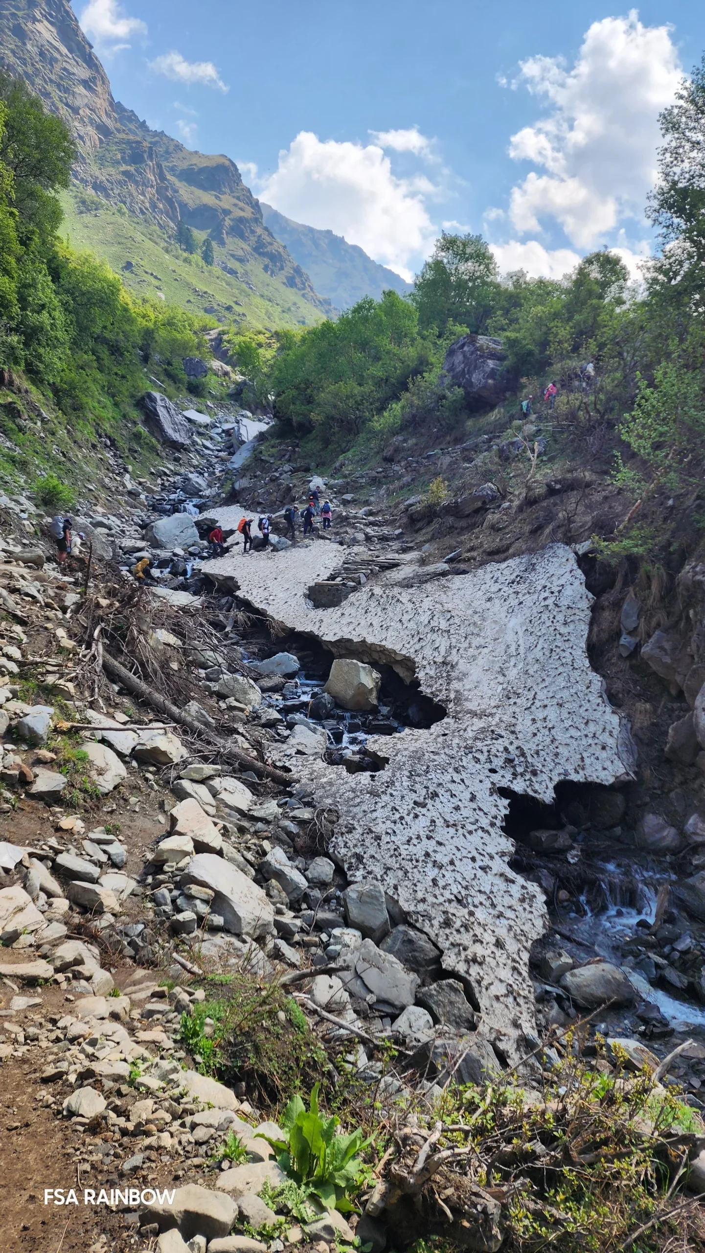
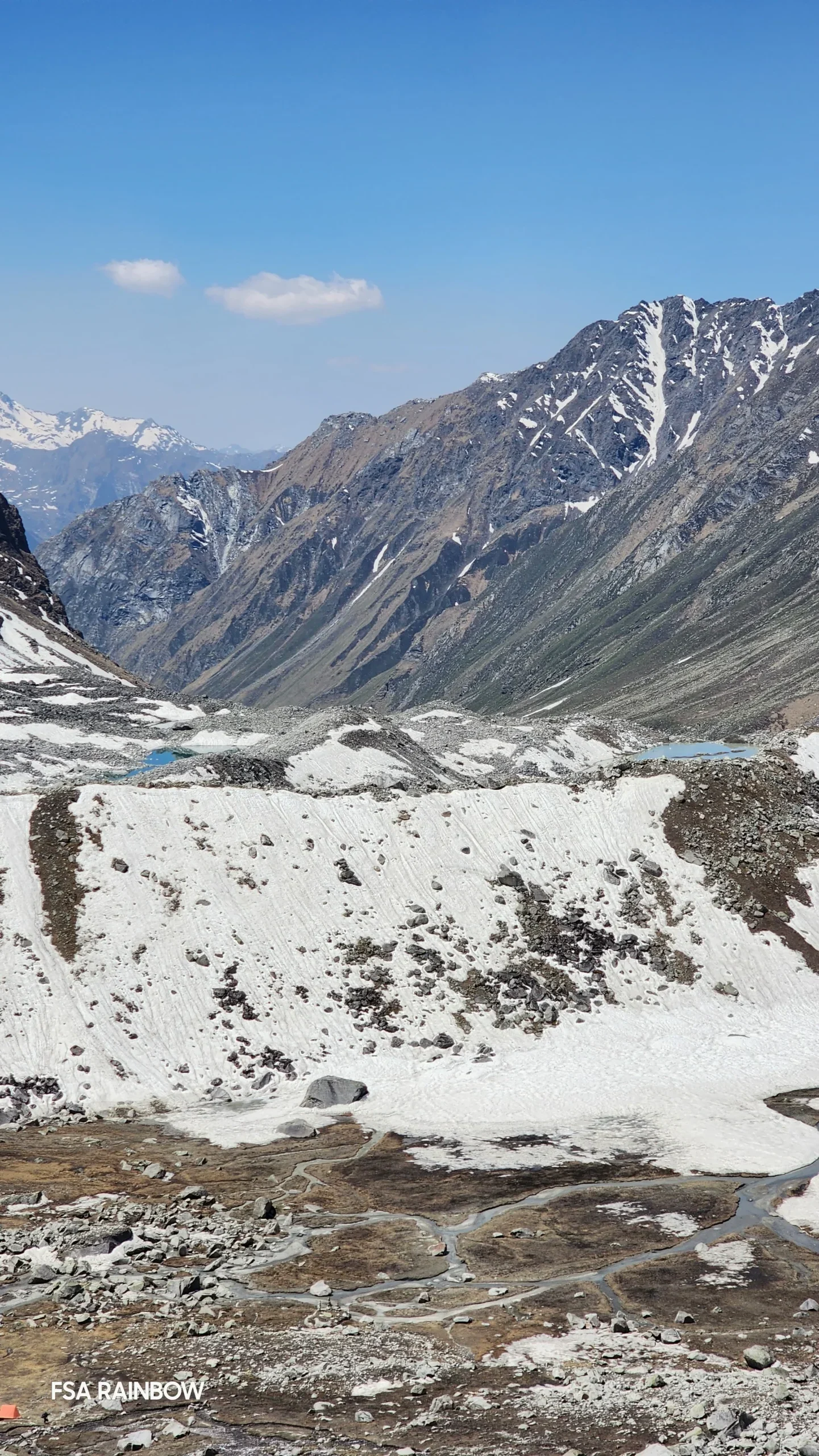
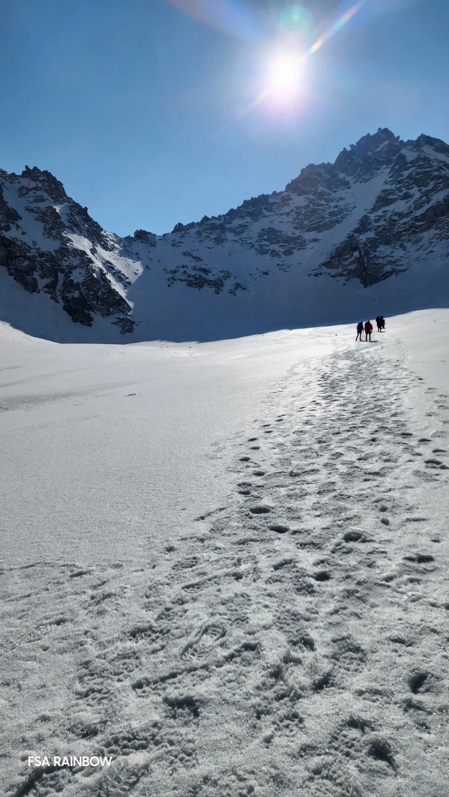
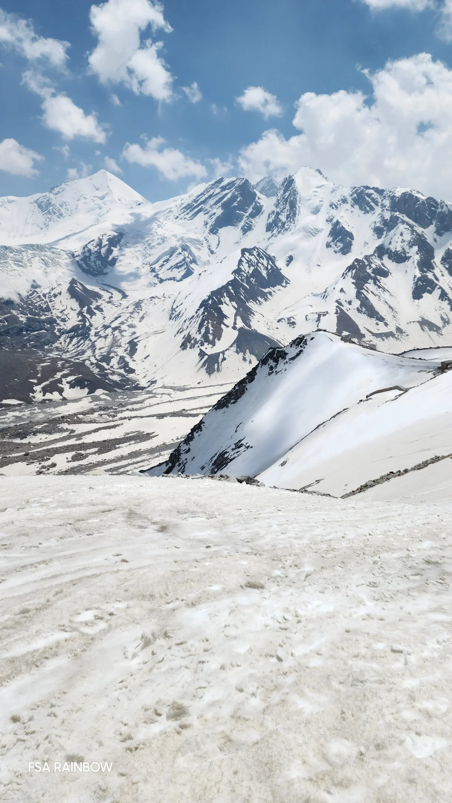
We reach the pass in around 3 hours. The view from the top which lies at the daunting altitude of 17880 ft is mesmerizing. Snow covered peaks with browns and whites playing chase with each other forming peculiar patterns on the high mountains all around. After a small prayer on the pass, we start the difficult part of the journey – the long and arduous descend. The first bit itself looks like a direct drop. It will require roping up or fixing ropes for a safe descent. The initial section, which is a 75 degree slope takes close to 40 minutes to descend. Post this, we hit a large patch of almost flat snow which slowly descends downwards. This section has a lot of open and hidden crevasses, however, and needs to be crossed with caution. It also has sections with steep slopes on one side which could take you straight down, in case of a single slip. By the end of 45 minutes on this terrain, we would have already descended 1000 ft and reached the end of the snow section.

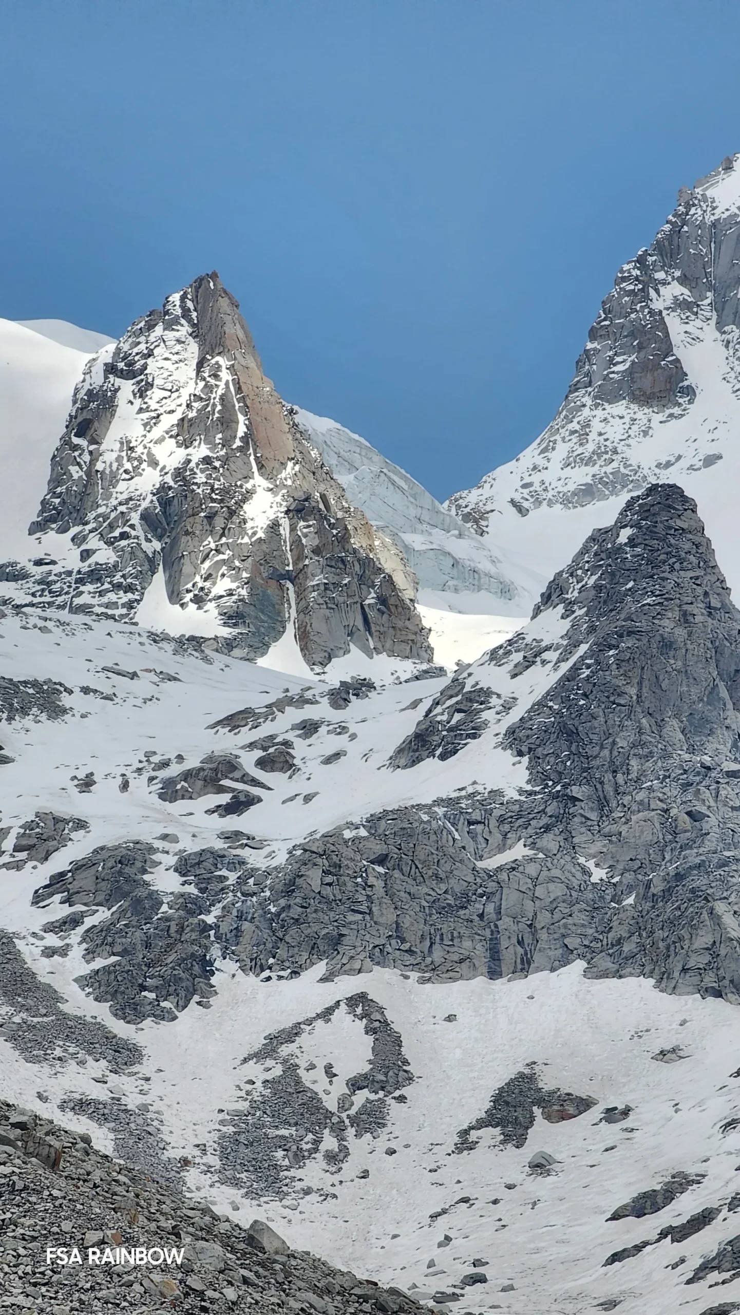
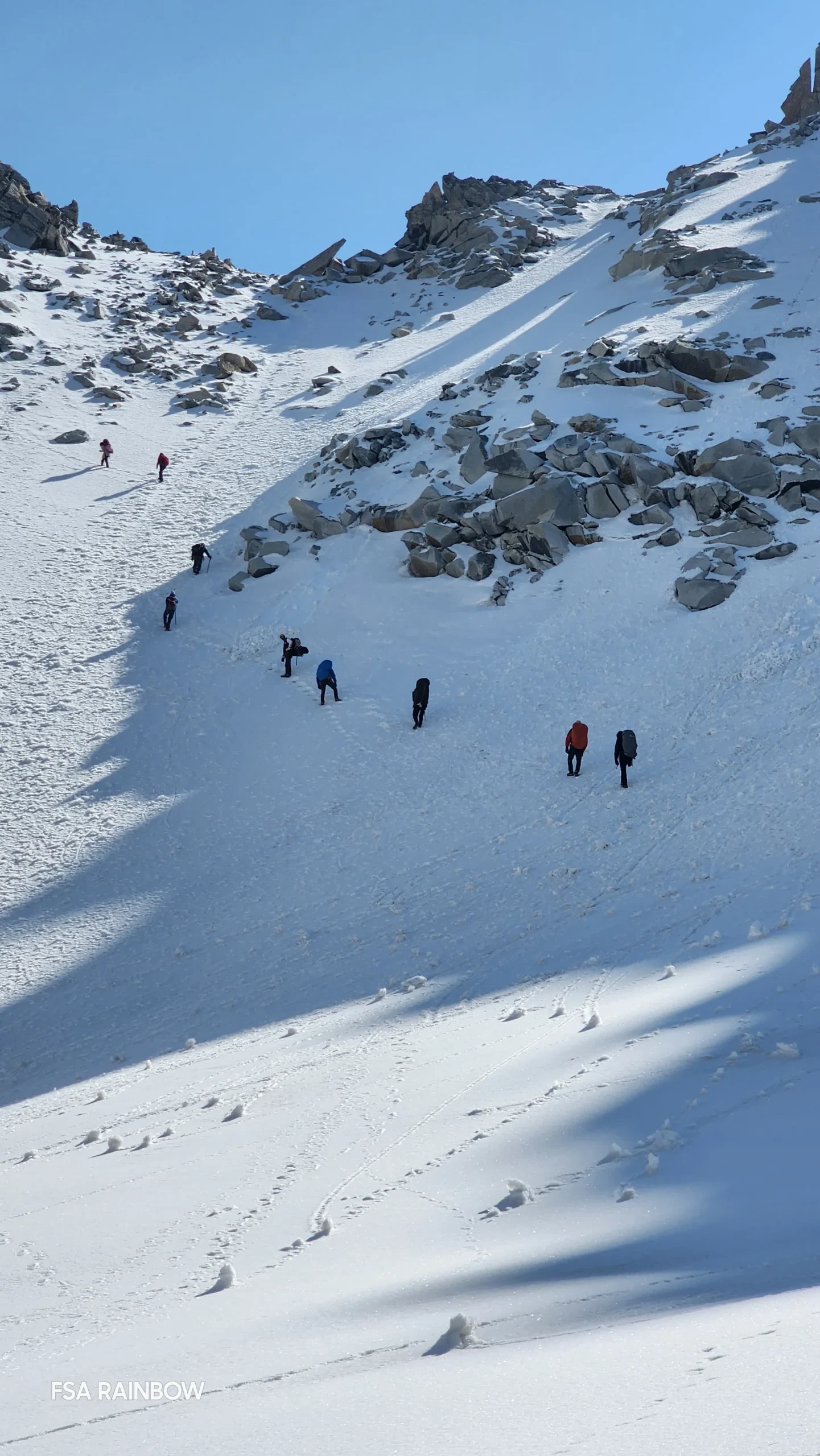
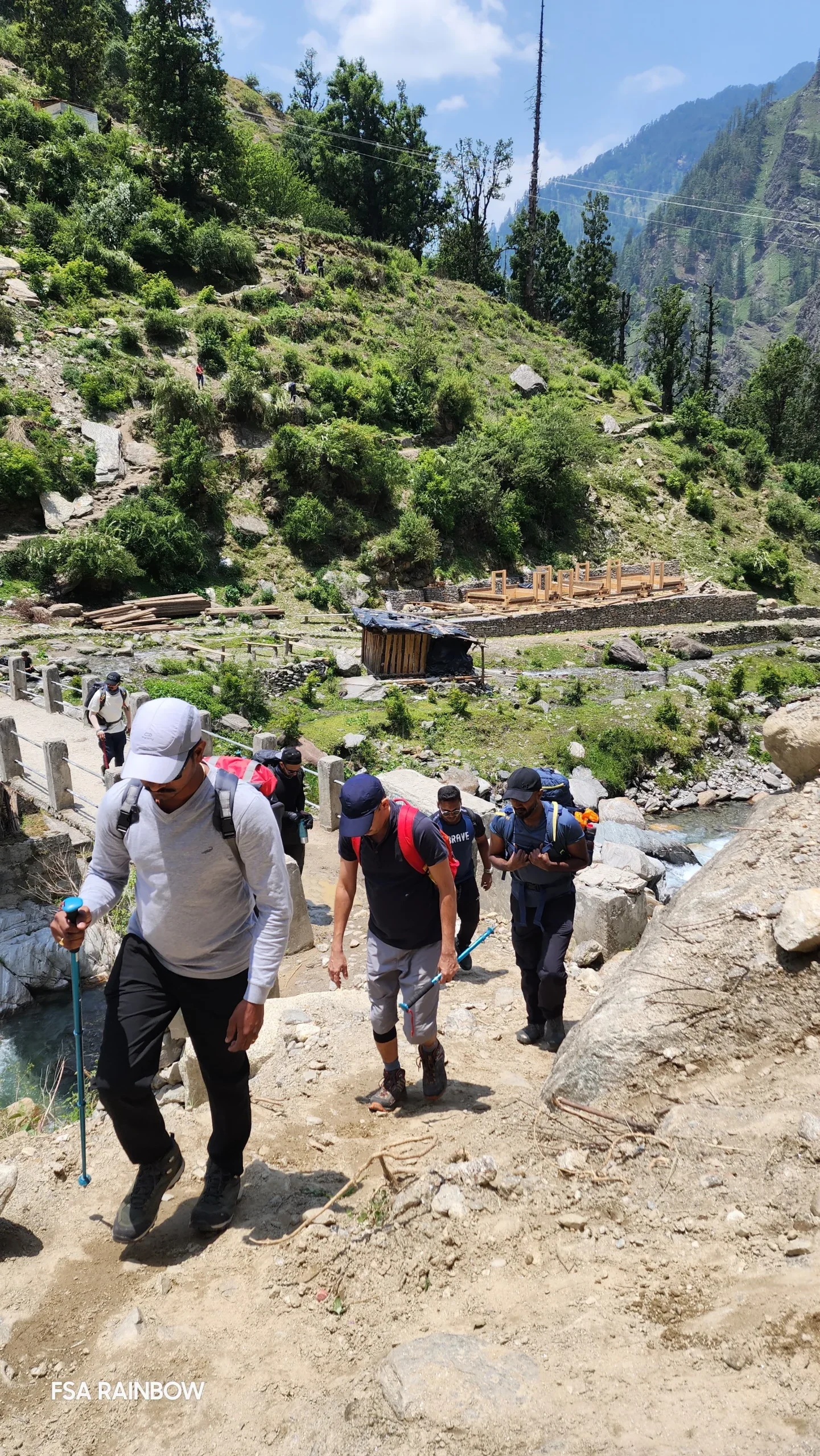
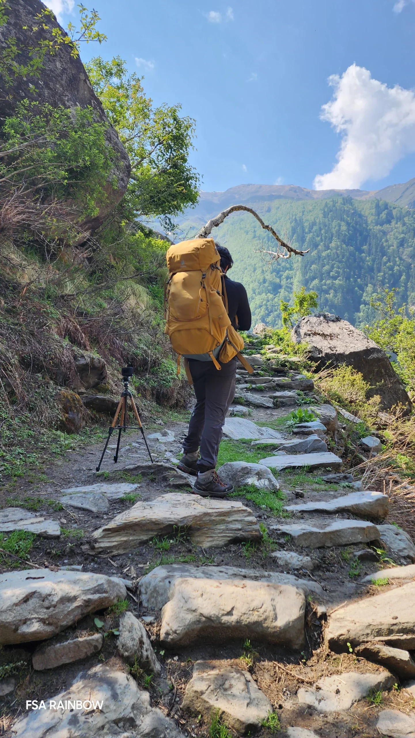
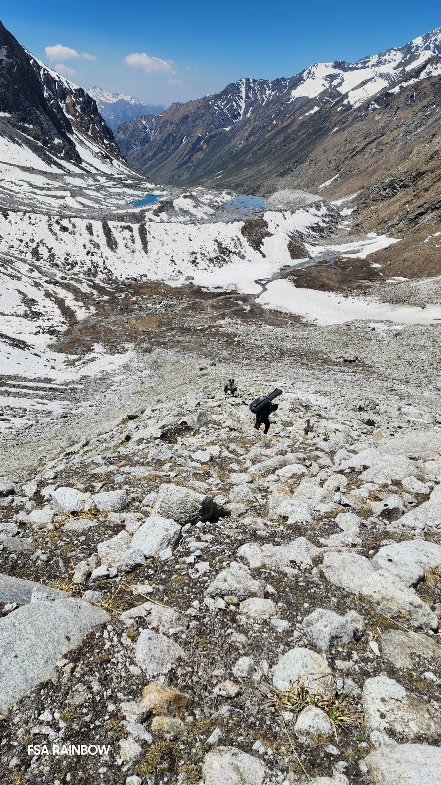
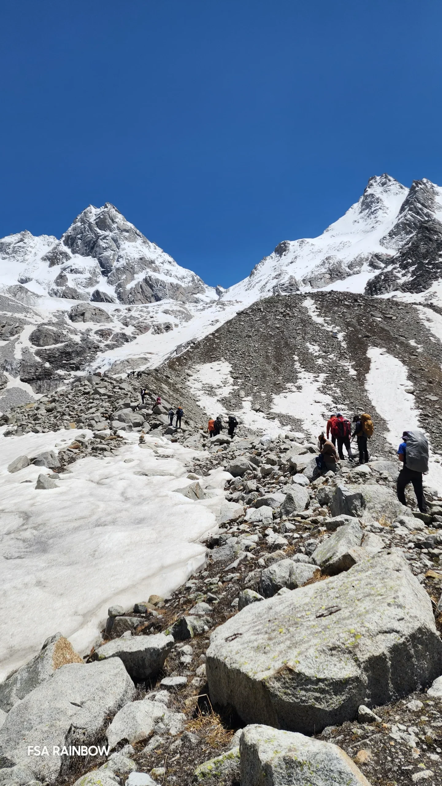
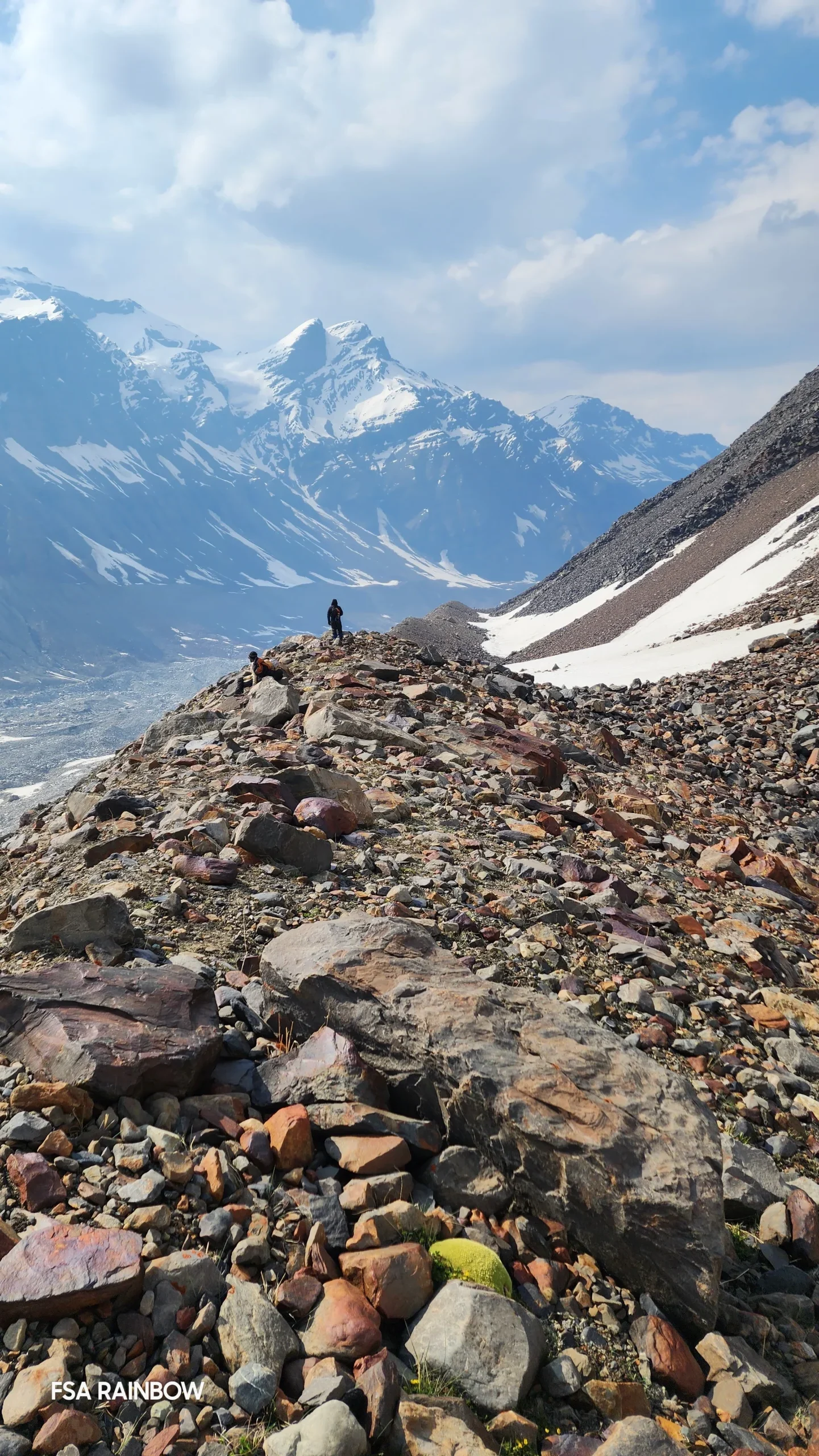
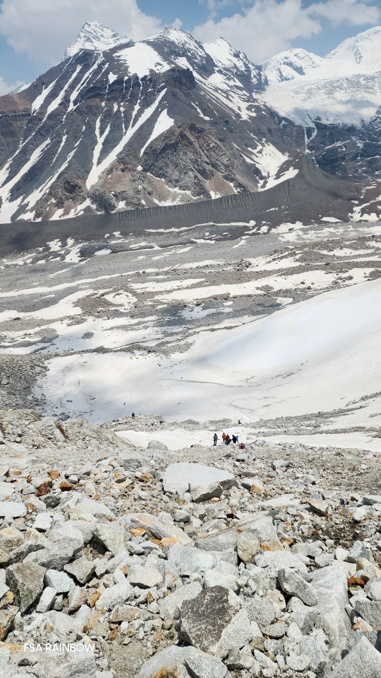
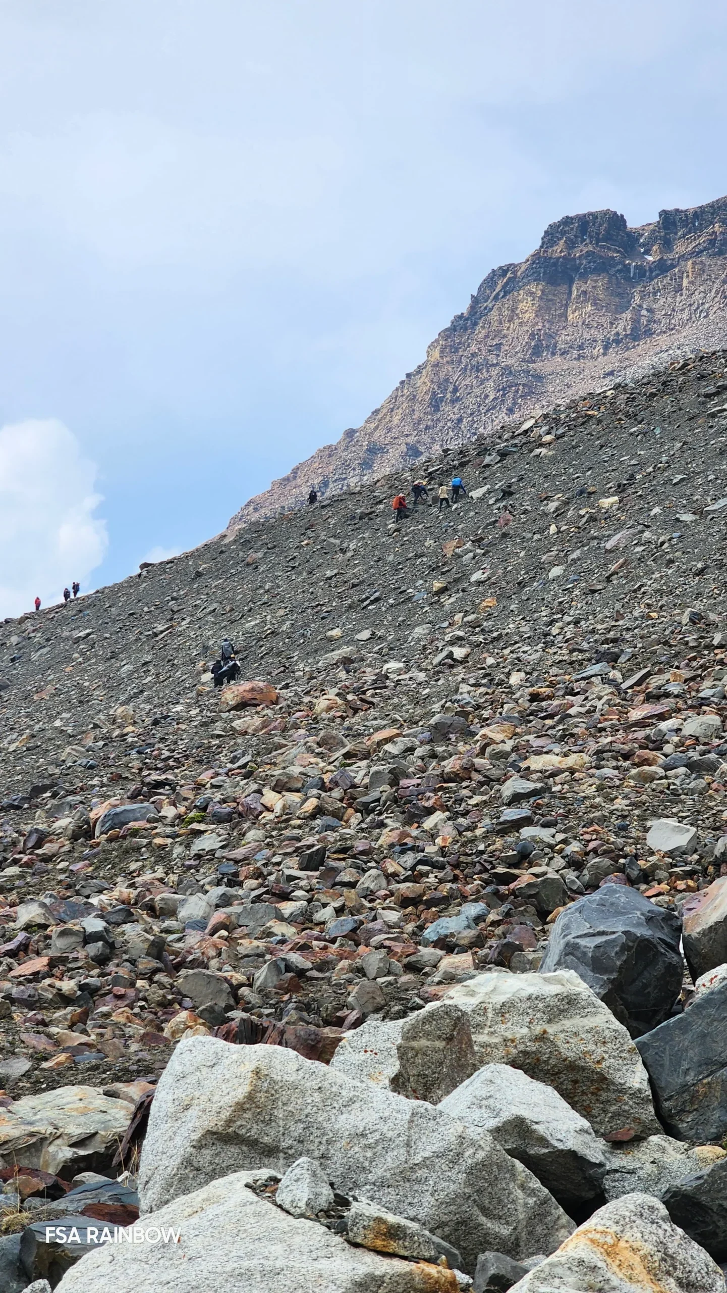
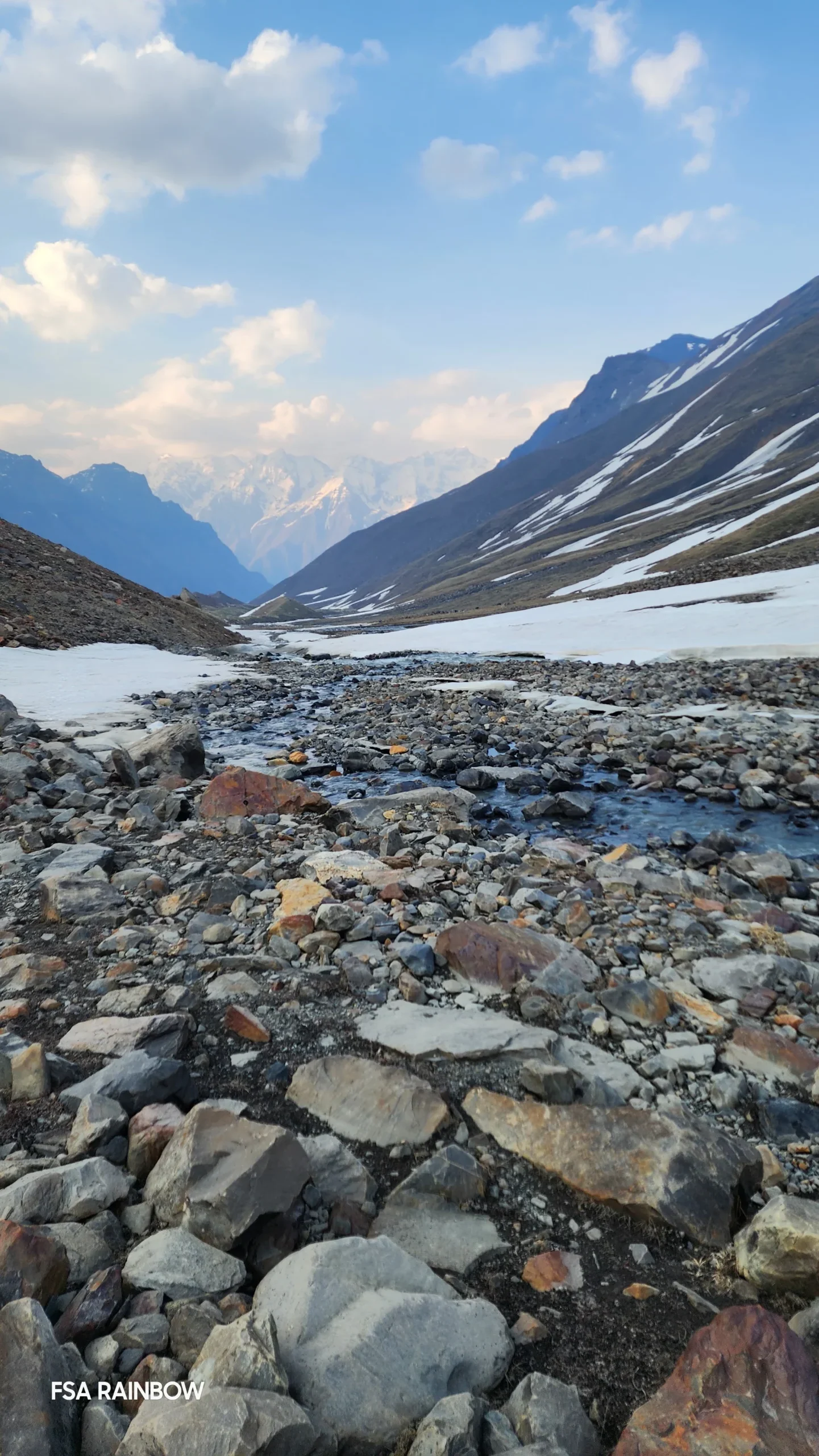
What comes next is especially daunting– hours of sharp ascend and descend on big boulders. The need to exercise caution on every tiny step forward, to avoid the gaps between these boulders, is extremely tiring. The next section which brings us down by 700 ft looks like a small distance to cover but takes close to an hour and a half. It is a steep descend with no specific trail and requires navigating massive boulders. Once at the base of this section, we will walk for 45 minutes on the rocky ground to make it to the mountains on the other side of the glacial bed. We need to catch the ridge of the mountain you see ahead. But in order to do that, we have to climb up a steep slope of scree and loose rocks. This section which will take not more than 50 steps to climb might make you think 50 times before you do it. Once on the ridge, the walk is pretty straightforward, although it is on a narrow trail with loose rocks, so you might want to be extra careful. Half an hour on the ridge and the landscape starts to fill a little with colour. The snow-capped peaks are now pushed into the backdrop. Streams can be seen and not just heard.

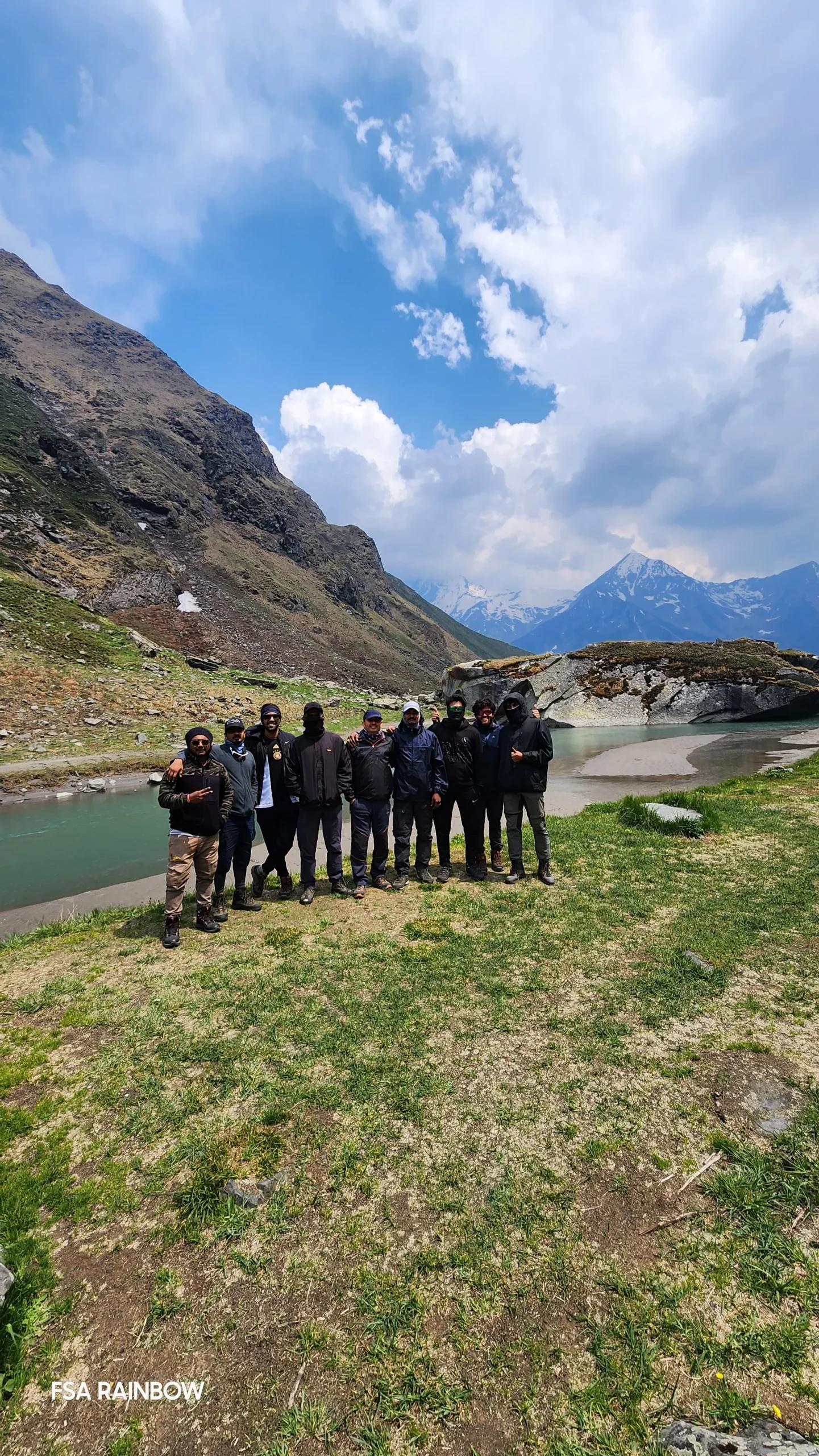
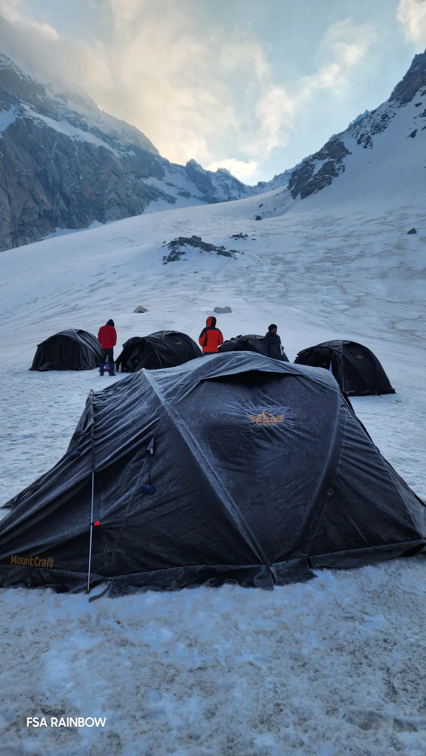
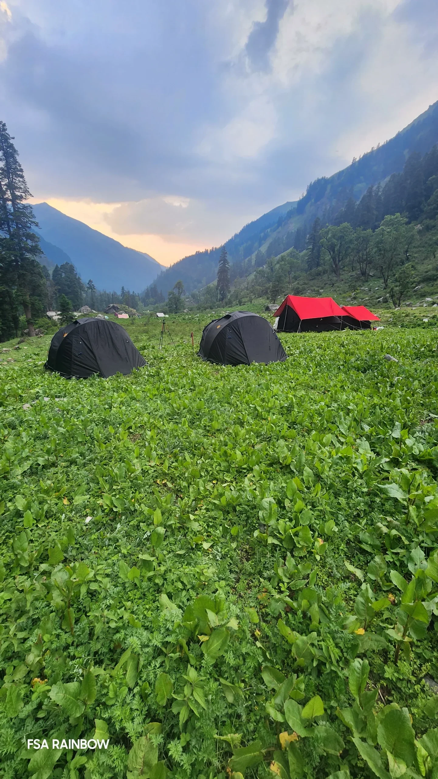
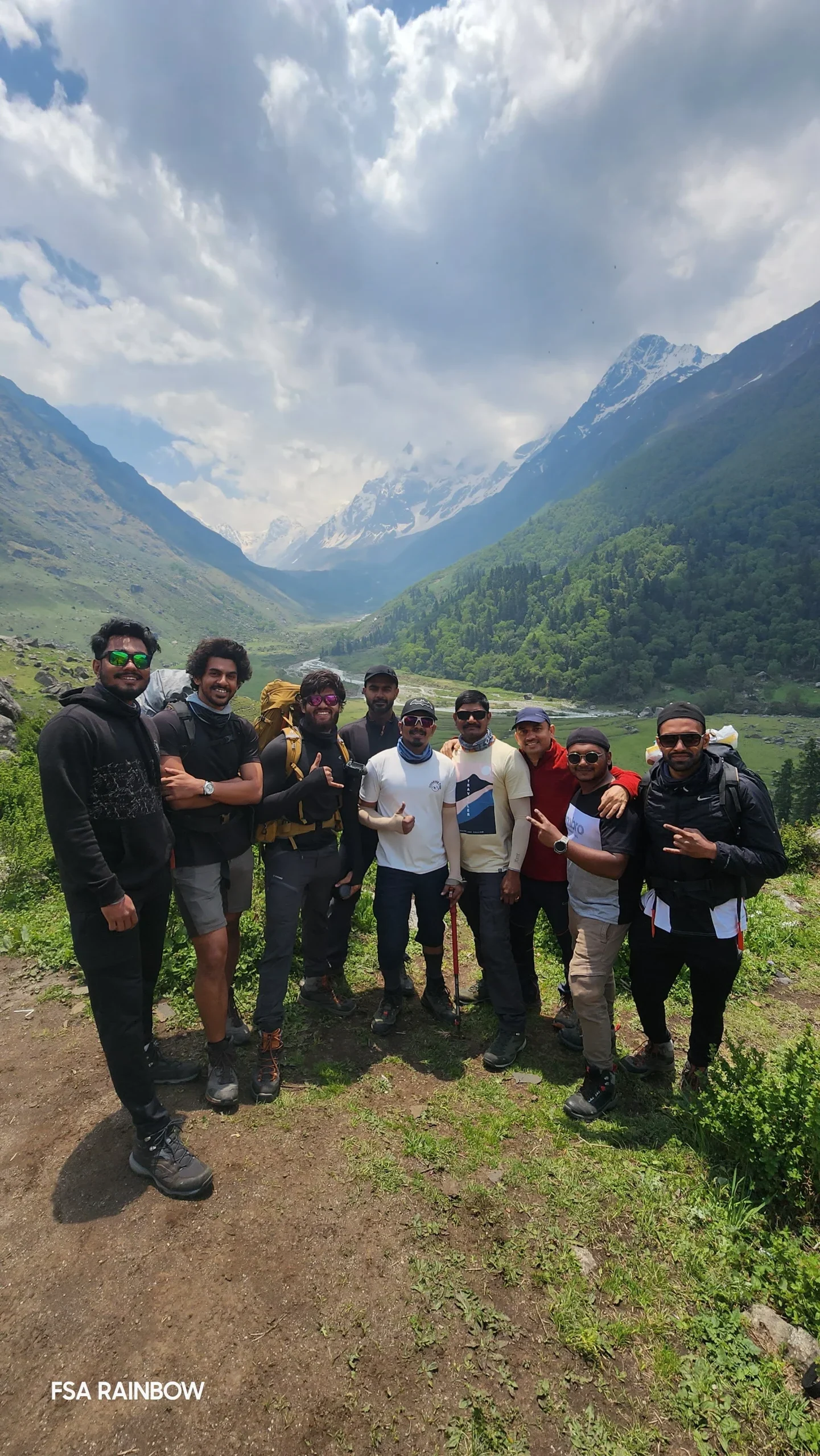
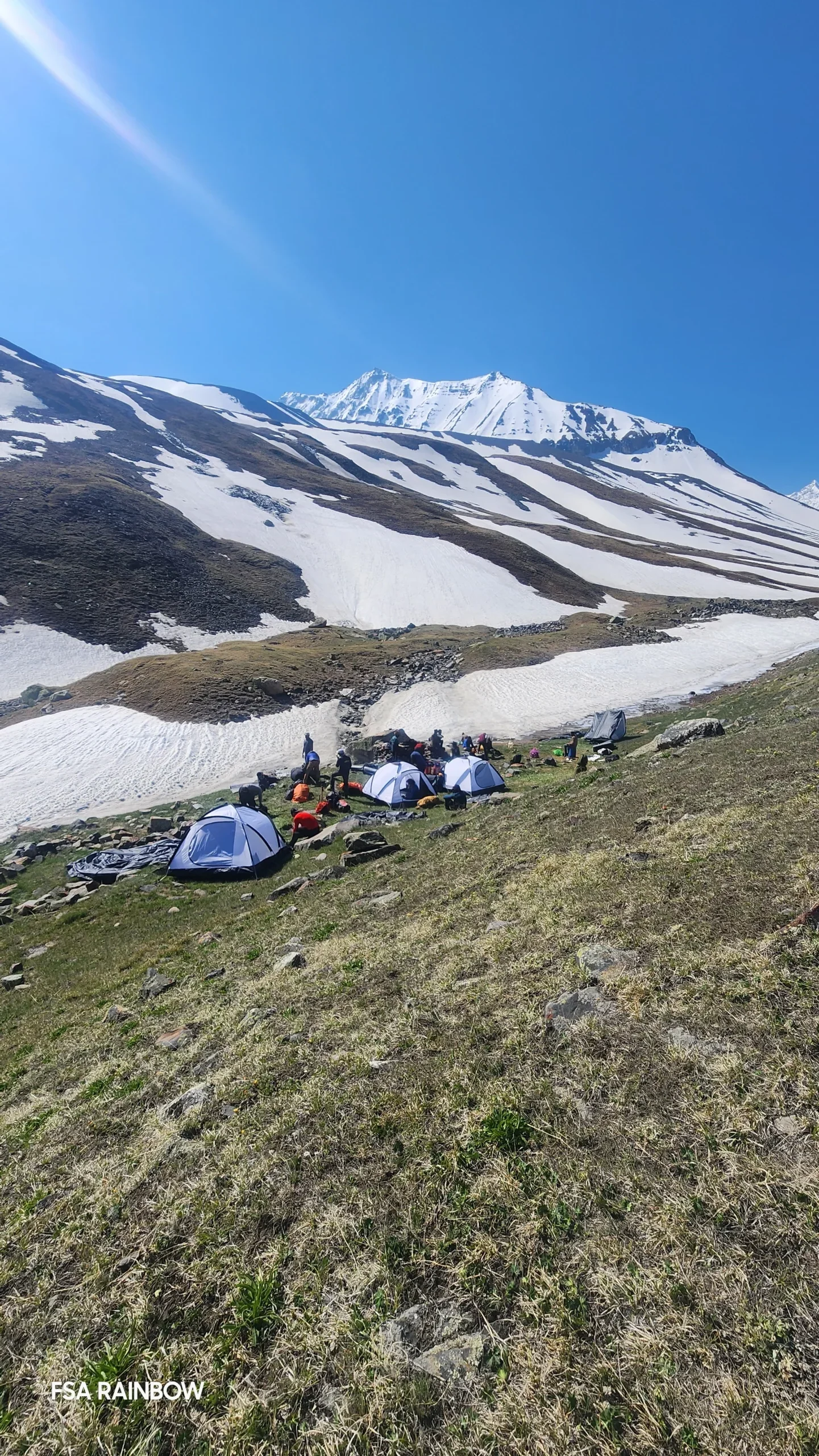
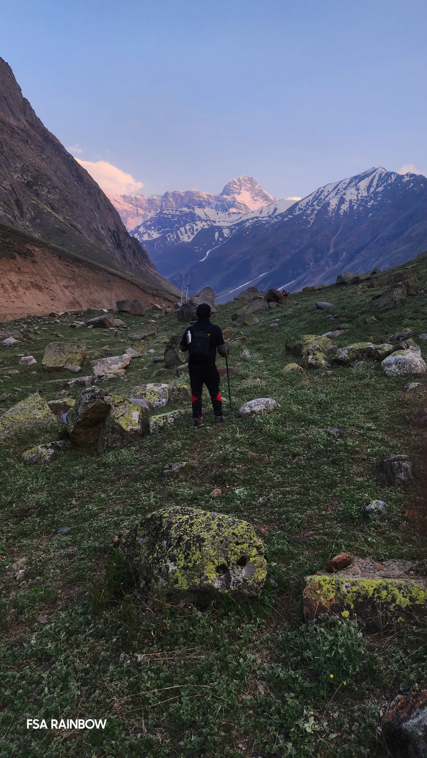
After walking the ridge and welcoming colour back into our field of vision for 45 minutes, we descend to take the lower ridge. Flowers get added to the mix of dry grass and life is starting to thrive in this terrain. Expect to reach the campsite for today by early evening. The campsite is in warmer lands with plentiful colours and a stream flowing by our tents.


Bonga (14800 ft) to Chhitkul (10800 ft) trek down.

Approx 14 kms – 8 hours.

The terrain for today includes a fair bit of steep ascends and descends, all on massive boulders across an exposed mountain face with a steep drop. There is no specific trail which makes things harder. After almost 3 .5 hours the tree line starts to appear. We could hardly contain our glee when we heard the crispy yellow leaves of entire mountains full of Bhojpatra trees make music in the air. Walking through thick, golden forests of Bhojpatra is extremely refreshing after the cold terrain we spent hours on.

An hour more and we reach open grasslands with huge humps taking us up and down – but the warmth of seeing life around us on these small hills keeps this a breezy walk. Once we make our way down to the river bed, there is one more small section of walking on rocks. By early eening expect to reach a small wooden bridge which takes you away from the mountain onto smooth roads on the other side of the bridge.

Chitkul, which is the end point of the trek is a two-hour drive from here.

Chhitkul to Shimla drive.
Approx 240 kms – 12 hours drive.
You are expected to reach Shimla by 8 pm. You can book your onward journey accordingly.

Inclusions in the package

* Dehradun to Sankri and Chhitkul to Shimla transportation in a shared Bolero/Sumo/tempo traveller or similar kind of vehicle
* Sankri to Taluka and Trek end point to Chhitkul transportation in a shared camper vehicle
* Guest House stay at Sankri on Day 1 and Chhitkul on Day 8 on sharing basis (3/4 person sharing in a room)
* All meals from Day 1 night till Day 9 Breakfast ( veg + egg ). Meals during trek ( Breakfast, Lunch, Evening snacks, Dinner ).
* Stay during trek on twin sharing basis in good quality tents
* Tent, Sleeping bag, Mattress, Kitchen tent, Dining Tent, Toilet tent, Kitchen utensils and kitchen equipments
*Technical equipments like Rope, Harness, Carabiner, Ice Axe, Microspikes, Gaiters as required.
* Mules / Porters to carry central luggage
* Medical kit for common health issues
* All necessary permits and entry fees
* Experienced trek leader and guide

Excluded from the package

* Transportation to Dehradun and from Shimla
* All meals during transit(Dehradun to Sankri and Chhitkul to Shimla)
* Any personal or group insurance
* Personal Backpack offloading charges ( INR 4000/Bag – your bag should not weigh more than 10 kgs )
* Additional accommodation and food expenses if trek gets delayed due to weather, health or any other reason.
* Expenses for evacuation and rescue operations due to natural calamity, mishaps, injury or any health issues.
* Tips for guide and kitchen staff.
*Anything that is not mentioned under Inclusions

Payment, cancellation & refund policy
Payment Policy 
 
50% advance during booking time & balance on or before 15 days to trek start date.
 
 
 Cancellations and refund policy
 
1. Cancellations prior to 30 days from the trek start date : 100% money refund
2. Cancellations prior to 15 days from the trek start date : 70% money refund or 100% voucher refund for any of our treks till one year
3. Cancellations prior to 7 days from the trek start date : No cash refund. Transfer your trek (same trek, same batch) to your friend or 100% voucher refund for any of our treks till one year
4. Cancellation within less than 7 days from trek start date, no cash refund or voucher refund.
 
**In case due to any unforeseen circumstances, if our company cancels the trek before starting, we would refund you your full cash paid amount.
Health Awareness
  • Pulse rate at rest must be in between (60 to 90 beats per minute)
  • Blood Pressure Reading must be in between (DIASTOLIC 75 – 85, SYSTOLIC 100 – 130 mm Hg)
  • Respiratory rate at rest must be in between (12 to 20 breaths per minute)
  • Should not have Liver and kidney issues
  • Should not have Diabetes Mellitus, Bronchial Asthma, Epilepsy, Heart problems, Hypertension etc
  • No pacemaker implant
  • People with the Sinus issues please contact to trek coordinator before booking the trek
  • If your BMI is not normal, Please contact our Trek coordinator before Trek booking.
Please Note
  • Junior trekkers (below 15 years) should have a company of parent/guardian.
  • Trekkers between 15 to 18 years can come solo with the disclaimer form signed by parent/guardian.
  • Medical & Disclaimer Form (Mandatory Documents)
    Click here to download the form”
Fitness
  • If your BMI is normal, you can plan your fitness regime as mentioned.
  • If your BMI is not normal, consult your trusted physician before you plan your fitness regime.
  • If you’re suffering from any chronic illnesses consult a medical practitioner.
BMI Calculator
Use this calculator to check your body mass index (BMI).
BMI Calculator
Unit type
Height
cm.
Please enter value between 125 and 225.
Weight
kg.
Please enter value between 10.0 and 500.0 ( one decimal ).
Height
ft.
in.
Please enter value between 4.2 and 7.3
Weight
lb.
st.
Please enter value between 22.0 and 1000.0 ( one decimal ).
Calculate BMI
Use this calculator to check your body mass index (BMI), which can be a helpful tool in determining your weight category. Or, use it to calculate your child’s BMI.
Frequently Asked Questions (FAQs)
Gallery of Borasu Pass Trek
Open Chat
💬 Chat Now via Whatsapp
Hello 👋
How may we help you?